Ariyalur at a glance
Ariyalur is the headquarters town of Ariyalur district in central Tamil Nadu. It lies about 72 km north-east of Tiruchirappalli, 32 km from Perambalur and 49 km from Thanjavur, on the dry red-soil plain that stretches north of the Kollidam river. The district was first carved out of Perambalur district in 2001 and, after a short merger, was formed again in 2007; since then the town has grown quickly around the Collectorate, the courts and the new medical college.
For most people in Tamil Nadu the name Ariyalur means one thing: cement. The ground here holds some of the largest limestone deposits in the state, and several large cement plants — the state-owned TANCEM factory and a number of private companies — line the roads around the town. Long rows of cement lorries, quarries and conveyor belts are part of everyday life, and the industry is the biggest employer after farming.
A town built on ancient sea beds
The same limestone tells a much older story. Around 65 to 100 million years ago, in the Cretaceous period, this area lay under a shallow sea. Its rocks are packed with fossils — coiled ammonites, sea shells, petrified wood and even dinosaur remains — and geologists from India and abroad have studied the "Ariyalur formation" for more than a century. The Fossil Museum at Varanavasi, a short drive from town, shows many of these finds in the middle of the very badlands where they were collected.
Temples, churches and birds
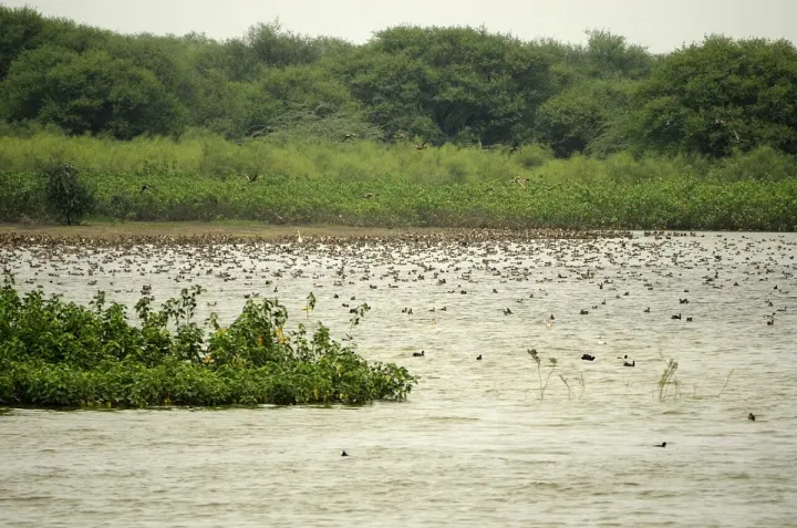
About 10 km away, the Kaliyuga Varadaraja Perumal temple at Kallankurichi is unusual: Vishnu is worshipped there as a tall wooden pillar, and its car festival in March – April is the biggest event of the district. Elakurichi, to the east, has the Adaikala Madha church built in 1711 by the Italian Jesuit Constanzo Beschi, remembered in Tamil literature as Veeramamunivar. In the winter months thousands of migratory water birds gather at the Karaivetti Bird Sanctuary, a Ramsar wetland about 21 km from town.
Farming, villages and daily life
Outside the cement belt, the Ariyalur, Thirumanur and Sendurai blocks are farming country. Villages near the Kollidam in Thirumanur block grow paddy and sugarcane with river water, while the drier uplands around Sendurai grow cashew, groundnut, cotton and millets. Ariyalur town is the market, hospital and office centre for all of them, which is why the bus stand, the vegetable market and the government offices are busy from early morning.
Getting to Ariyalur
Ariyalur railway station (ALU) is on the main line between Chennai and Tiruchirappalli through Villupuram and Vriddhachalam, so most Chennai – Trichy express trains stop here. Government and private buses run often to Perambalur, Jayankondam, Thanjavur, Kumbakonam and Trichy. The nearest airport is Tiruchirappalli International Airport, roughly an hour and a half away by road.
How far is Ariyalur from nearby towns?
By road, Ariyalur is 32 km from Perambalur, 37 km from Jayankondam, 49 km from Thanjavur, 50 km from Lalgudi, 52 km from Andimadam, 66 km from Kumbakonam and Virudhachalam, 72 km from Tiruchirappalli and 86 km from Chidambaram. Chennai is about 289 km by road (about 253 km to the Kilambakkam bus terminus), Madurai about 196 km and Salem about 142 km.
Ariyalur district at a glance
Ariyalur district has six panchayat union blocks — Ariyalur, Thirumanur, Sendurai, Jayankondam, Andimadam and T.Palur — and about 200 village panchayats. The town itself sits in the middle of three of them: Ariyalur block (37 village panchayats), Thirumanur (36) along the Kollidam, and Sendurai (30) to the north. The Collectorate, the district court, the government medical college and hospital, and most district offices are in Ariyalur town, so people from every corner of the district come here for official work.